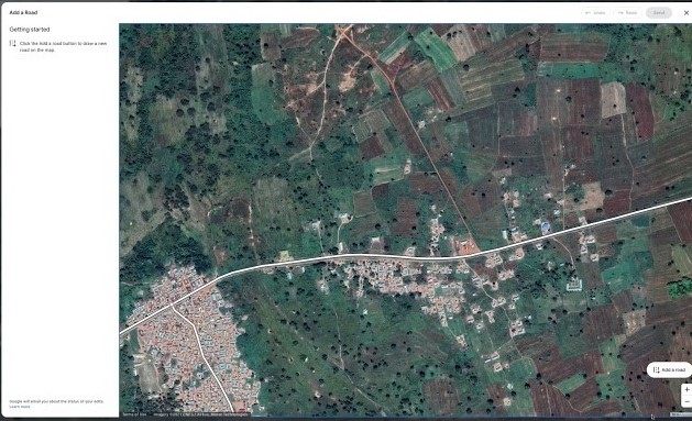
Google Maps new feature will allow users to draw, rename missing roads
"A Google Maps photo update is a recent snapshot of a place with a short text description, without the need to leave a review or rating," it added. Tech giant Google will finally be updating its map editing experience in order to allow users to add missing roads and realign, rename, or delete incorrect ones.
Google relies on 170 billion high-definition Street View images from 87 countries, contributions from hundreds of millions of businesses and people using Google Maps, and authoritative data from more than 10,000 local governments, transit agencies, and organizations. That same screen also says that it will take about seven days for the company to review the submission.
"You can even let us know if a road is closed with details like dates, reasons, and directions. To make sure the suggestions and edits are accurate, we'll vet contributed road updates before publishing them," Reece informed.

In the coming weeks, the company said it will roll out a new content type in Google Maps: photo updates which is an easy way to find and share experiences and highlights with recent photos.
It is obvious that Google will still oversee the corrections to make sure that they are accurate. After the submission of a change, Google will display a screen where it warns that it does not want a bike path to be marked as a road, or for someone to make a road intended to hurt people.
Inside the app, it would be possible to add images of a location as well as see recent photos with text snippets submitted by others. Photo updates can help people make more informed decisions with a place's most recent images. You can add missing roads by drawing lines, quickly rename roads, change road directionality, and realign or delete incorrect roads.


